

Santa Fe is the easternmost spot on my journey, and from here, I’m heading north and west. Shannon wanted to visit her family ancestral lands near Shiprock, NM, and I was only too happy to tag along. So we packed up and set off in our SUVs, up through Abiquiu, the area where Georgia O’Keeffe created some of her most remarkable art work. Abiquiu is a very small town, and it looks a little dilapidated these days. Still photogenic, though.


I wonder what the Piñon Saloon was like in it’s heyday? Such is my sense of humor, I found the sign on this church’s cross quite amusing. We stopped at Lake Abiquiu for lunch, a spot where Shannon’s family would frequently travel to let the kids loose on a Sunday. The lake is very low, it’s clear the land is experiencing a severe water shortage.

New Mexico Highways 96 and 44 and US 64 wend up into the northwest corner of the state, through Farmington, where Shannon’s grandparents lived. Shiprock is a bit further west, and as we approach the town, an iconic rock peak emerges from the desert.
This looks strangely familiar, even though I’m not aware of driving through this area before. Then it hits me, my family drove to Shiprock when I was 4 years old. It’s an odd story — my father worked for the US Geological Survey, and was assigned to Lee’s Ferry, Arizona in the fall of 1962 to monitor sediment flows in the Colorado River after Glen Canyon Dam was completed. We stayed in a tiny adobe hut there for six weeks, a 2 hour drive from the nearest trading post in the Navajo reservation. One weekend, my dad wanted to drive further on out to see Shiprock, so we not only picked up groceries, we went east perhaps an extra hundred miles. I now remember seeing the strange rock formation, and the surprising dejá-vu experience is rather eerie. Shannon and I drive out across the desert several miles to reach the base of the rock itself.


Shortly after we cross the state line, the open arid desert gives way to more mountains and trees. Why is it that the feeling of the land changes so abruptly when we cross a state line? I’ve seen this over and over in my travels, how the same landscape both feels different and changes quickly. We arrive in Durango in time for dinner, where we meet a mutual friend, and then part company after almost a week together. I find a nice little private motel on the north side of town, and tuck in for the night.
This is the first time I’ve had a chance to explore Durango, so the next morning I’m out walking the downtown area, shopping and tasting some local wines. I chat with the vintner about my desire to head north, and he makes several great suggestions. By early afternoon, I’ve wandered up US 550 through spectacular mountains and aspen forests changing color, into the town of Ouray.


Now THIS is a fun place, quirky, friendly and charming, I find a fine lunch in a saloon with the coolest bar chairs I’ve ever seen, then pick up a few items at the local hardware store. Again, the proprietor is only too happy to fill my ear with suggestions about places to drive and explore, as I’m planning to camp tonight. I just happen to park in front of one of the most interesting buildings I’ve seen. Who is the Ouray Alchemist (note the name in the stonework over the shop)? Did he build this building? And does he live in the space above his shop? The mysteries are unsolved, I have no way to find out as the shop is closed.
I’ve never been to Telluride, home of bluegrass and jazz festivals, and this is a perfect opportunity. Driving up to Ridgway and west through Placerville, I find the one-way-in-and-out road and drive in. As it turns out, Telluride is a lot like Aspen, it’s an expensive commercial oasis full of people from other places. I ask around, and learn that everyone in the shops has come from somewhere else. I also learn that nearly the entire town is owned by one corporation, explaining the feeling of the place. I don’t dawdle, I head back out toward the real parts of Colorado. About 20 miles west of town, before I hit the highway, I turn up one of the forest roads and find a cute little quiet campground while it’s still light. I can even have a campfire. This is Perfect. (FYI, turn south on 57P Road a few miles to the Fall Creek Recreation Site!)

The October 1st morning is freezing cold, though I was completely snug in my sleeping bag and blankets. Both tent and ground are crunchy with frost, and I make coffee quickly. It takes me about ten minutes to pack up, and I am on the road back towards Ridgway and points north. In Olathe, a sign points up a hill toward a winery, and I cannot resist. Wine tasting in the morning could turn into a very bad habit for me, but what the hell, I’m on vacation. Much to my surprise, this small farm makes quite an excellent sauvignon blanc, and a very pleasing rosé, so I buy a few bottles.
Driving on through Montrose. I don’t know what I expected, perhaps the French-is name suggested something exotic, but I’m not particularly impressed. Montrose is a plain little town, with no discernible character. Perhaps I didn’t explore enough (though I did buy a really nice kitchen knife as a gift for my stepsister!) In any case, I head on towards Grand Junction and the Colorado River. The country is getting drier as I drive north, less mountainous and more like the high Rockies in Wyoming. Grand Junction is basically a gigantic train depot with an interstate running through it, so I don’t stop, and take a short eastward zag on I-70 to Rifle. Along the way, I spot a motorcyclist at the side of the road, and stop to lend a hand. He fortunately had just enough cell coverage to call a shop in Grand Junction, so I keep him company until a van arrived to pick him and his bike up. I love to see folks doing long trips on a bike, and he was in the middle of an excursion from the midwest out to the west coast and back.


From Rifle, I choose the back roads up to Rock Spring, Wyoming. This is my nicest afternoon of driving on the whole trip so far. First of all, in the plains near Rio Blanco, I see road signs marking the beginning and end of the Big Sandy National Forest…100 yards apart, bracketing the only tree in sight. Someone has a sense of humor! At Meeker, the highway becomes a dirt road up through the tiny spots of Price Creek, Maybell, and Sunbeam. For well over a hundred miles, I see almost no one, perhaps two pickup trucks, no houses, ranches or trees. But I get spectacular views, lovely mountains, and spot both antelope and grouse near the road. The dirt highway crosses into Wyoming, and after 30 more miles, I see my first signs of civilization since noon.


Just before sunset I drive past a petroleum processing plant, over one last hill, and into Rock Creek. Now this town is spooky. It feels both corporate and Mormon at the same time. The profusion of Trump signs and the complete lack of any visible humans gives no desire to stop, even though the older center of town looks interesting. I drive right through out to I-80, where I find a chain hotel for the night. Much to my surprise, the hotel has a really good Mexican restaurant, full of local Latino families. This feels like home, washing away the weird vibe of the town itself, and I feast on excellent spicy enchiladas.
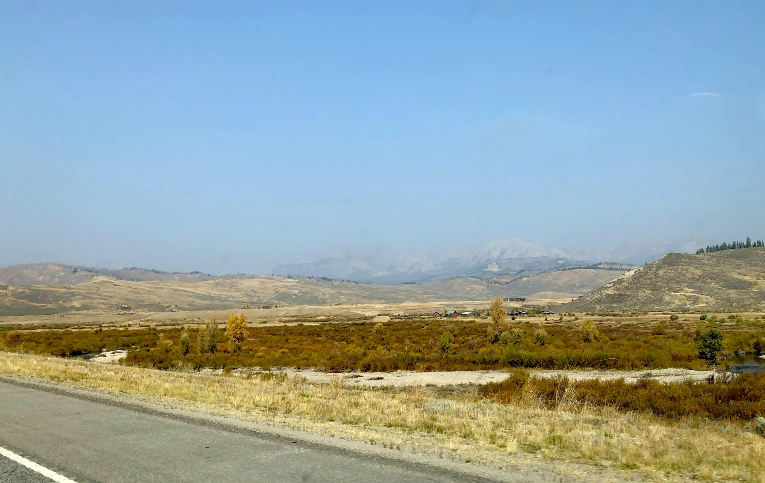
US 187 goes up towards Jackson, one of my favorite places to visit. The next day I’m out early, and by mid-morning I’m seeing the Grand Tetons in the distance.
As I get closer, I’m feeling the spirit and power of the land more and more, and I’m remembering how special the entire area around Yellowstone park is. Perhaps it’s the geologic hot spot underneath, I don’t know, but the felt sense of the land delights me to my core. When I arrive near the mountains, I see mile after mile of burned forest, and after a few construction delays, land in Jackson for lunch.

Jackson Hole is a hoot. It has a touristy vacation-y vibe, yet the locals are friendly, easy going and fun. There is a mixture of long time residents and visitors, and a sense of humor about it. I wander into a place called the The Local Restaurant and Bar, find a superb lunch, discover a new whiskey, and hang out chatting up the bartender and (indeed) some locals. Before I get too intoxicated, I head back to the trusty X5, and drive over the hills westward to Victor, Idaho for another hotel evening.
If there is one thing I’m learning, it’s that I have to be careful making sweeping generalizations about towns, states or cultures. Small towns everywhere have lots of Trump signs — except Santa Fe, Durango, Ouray, Jackson and Victor. Every place along an interstate is careful about wearing masks, and though I hate the roadside culture next to our superhighways, I also find it safe and reassuring when I’m in Trump country. Places that attract tourists, like Santa Fe and Jackson, require everyone to wear masks everywhere.
I’m also learning that my black SUV is pretty anonymous. I was expecting some crap somewhere about driving a BMW from California, but there has been nary a peep. Until I bought the X5, I hadn’t really noticed how many black SUVs are on the road, and now I feel like a pine cone in a pine forest. I’m enjoying my invisibility.
It has been a beautiful five days of driving, since I left Santa Fe. Southwestern Colorado and the Jackson Hole area are liberal, pretty, warm and friendly. I could live here too.